place

Macatawa River

Michigan river stubsRivers of Allegan County, MichiganRivers of MichiganRivers of Ottawa County, MichiganTributaries of Lake Michigan
West Michigan geography stubs
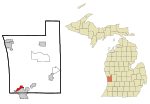
Macatawa River Holland Charter Township Michigan

The Macatawa River, also known as the Black River, is located in the lower part of Ottawa County, Michigan, which drains into Lake Macatawa and eventually into Lake Michigan. The main stream is 16.8 miles (27.0 km) long.Preluding the migration of Dutch settlers, the region was originally inhabited by three Anishinaabe nations: the Ottawa, Ojibwe, and Potawatomi. Together they comprised the Council of Three Fires who spoke the Algonquian languages. The indigenous name of the river is approximated to be the word “mak-a-tew-gamie”, meaning “black water” in the Ottawa dialect. Because they spoke oral languages, the name was written by the European immigrants in twenty-five variations, which led to the mis-phoneticized word Macatawa used today.The Macatawa River Greenway is a corridor of land along the river including a number of private and public parcels that provides a green highway for wildlife and recreational opportunities for people along the water. Land along the Macatawa River open to the public includes: Upper Macatawa Natural Area, Hawthorn Pond, Adams Street Landing, Ridge Point Community Church Natural Area, Paw Paw Park, Windmill Island, Window on the Waterfront Park, Dunton Park, Kollen Park and Holland State Park. A number of entities contribute to the management of the public areas along the Macatawa River Greenway including: Outdoor Discovery Center Macatawa Greenway (non-profit), Ottawa County Parks and Recreation Commission, City of Holland, Zeeland Township, Holland Township and Park Township.

Excerpt from the Wikipedia article Macatawa River (License: CC BY-SA 3.0, Authors, Images).

Macatawa River
Kollen Park Drive, Holland

Geographical coordinates (GPS) Address Nearby Places
placeShow on map

Wikipedia: Macatawa RiverContinue reading on Wikipedia

Geographical coordinates (GPS)

Latitude Longitude
N 42.78891 ° E -86.12476 °
placeShow on map

Address

Kollen Park Drive
49423 Holland
Michigan, United States
mapOpen on Google Maps

Macatawa River Holland Charter Township Michigan
Share experience

Nearby Places

Holland, Michigan
Holland, Michigan

Holland is a city in the western region of the Lower Peninsula of the U.S. state of Michigan. It is situated near the eastern shore of Lake Michigan on Lake Macatawa, which is fed by the Macatawa River (formerly known locally as the Black River). Holland is a thriving city with a diverse economy that includes manufacturing, agriculture, tourism, and higher education. It is home to a number of prominent companies, including Herman Miller, Haworth, and Johnson Controls. The city also attracts thousands of visitors each year for its annual Tulip Time Festival, which celebrates the area's Dutch heritage and vibrant tulip fields. The city spans the Ottawa/Allegan county line, with 9.08 sq mi (23.52 km2) in Ottawa and the remaining 8.13 sq mi (21.06 km2) in Allegan. As of the 2010 census, the population was 33,051, with an urbanized area population of 113,164, as of 2015. Holland is the largest city in both Ottawa and Allegan counties. The Ottawa County portion is part of the Grand Rapids-Kentwood Metropolitan Statistical Area, while the Allegan County portion is part of the Holland Micropolitan Statistical Area, which is coextensive with Allegan County. As of 2013, both areas are part of the Grand Rapids–Kentwood–Muskegon Combined Statistical Area. Holland was founded by Dutch Americans, and is in an area that has a large percentage of citizens of Dutch American heritage. It is home to Hope College and Western Theological Seminary, institutions of the Reformed Church in North America.