place

Coleby, North Lincolnshire

Borough of North LincolnshireHamlets in LincolnshireUse British English from October 2014
Coleby, North Lincolnshire

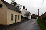
Coleby is a hamlet in the civil parish of West Halton in North Lincolnshire, England. It is situated approximately 7 miles (11 km) north from Scunthorpe, and 3 miles (5 km) south from the Humber estuary. Coleby pre-dates the Norman Conquest, its name derived from Old Norse meaning the "farmstead of a man named Koli". It was described in the Domesday Book.Coleby has 28 dwellings including 3 farms: Eastdale Farm, Hall Farm and Manor Farm. The village has allotments, but no shops or public houses, and its telephone box was removed in 2008. Public Transport is provided by Stagecoach Lincolnshire and subsidised by North Lincolnshire Council.Internet is delivered by ADSL through underground, waxed-paper insulated copper wires that were laid by the GPO in 1955. FTTC is not yet available because the cabinet is too far away. As of July 2018, FTTP/Ultrafast broadband is now available in the village with a speed guarantee of at least 100Mb with ULTRAFAST FIBRE 2 PLUS Average speed 300Mb from BT.

Excerpt from the Wikipedia article Coleby, North Lincolnshire (License: CC BY-SA 3.0, Authors, Images).

Coleby, North Lincolnshire

Geographical coordinates (GPS) Address Nearby Places
placeShow on map

Wikipedia: Coleby, North LincolnshireContinue reading on Wikipedia

Geographical coordinates (GPS)

Latitude Longitude
N 53.666 ° E -0.64 °
placeShow on map

Address


DN15 9AL
England, United Kingdom
mapOpen on Google Maps

Coleby, North Lincolnshire
Share experience

Nearby Places

Julian's Bower
Julian's Bower

Julian's Bower or Julian Bower is a name given to turf mazes in several different parts of England. Only one of this name still exists, at Alkborough in North Lincolnshire. It has also been known by corrupted forms of the name, such as "Gillian's Bore" and "Gilling Bore". The 18th-century antiquary William Stukeley mentions a "Julian Bower" turf maze at Horncastle, Lincolnshire, and in nearby Louth there was a "Gelyan Bower", mentioned in accounts of 1554. At Goathland, North Yorkshire, there was a "July Park" or "St Julian's" maze. At Whinfell Forest there is a farm called Julian Bower, originally built to support the Keeper. It now lies outside the forest boundary. Some English turf mazes are very similar in their layout to Scandinavian labyrinths, which usually have their paths marked with stones. At Grothornet, in Vartdal in the Sunnmore Province of Norway, there is a stone-lined labyrinth called "Den Julianske Borg" ("Julian's Castle"). The name is believed to be derived from Julus, son of Aeneas of Troy, and the word place-name element burgh, meaning "a fortified place", "fort" or "castle". The reasoning behind this etymology is based on the fact that many mazes and labyrinths in Britain were called "Troy", "Troy Town" or "The Walls of Troy"; similar names, such as "Trojaburg", "Trojburg" or "Trelleborg", were used in Scandinavia. In popular legend, the walls of the city of Troy were constructed in such a complex and confusing way that any enemy who entered them would be unable to find his way out. On a clear day, Emley Moor TV tower (40 miles), the top of York Minster and the Kilburn White Horse (45 miles) can be seen from Julian's Bower.

Roxby, Lincolnshire
Roxby, Lincolnshire

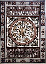
Roxby is a village in North Lincolnshire, England. It is situated approximately 4 miles (6 km) north from Scunthorpe and 1 mile (1.6 km) south-east from Winterton on the A1077. Roxby stands on a prominent part of the Lincoln Cliff and overlooks the Humber Estuary. Roxby has fewer than 500 inhabitants, and forms part of the civil parish of Roxby cum Risby (where population details are included), which also includes the hamlet of Dragonby.Roxby Grade I listed Anglican church is dedicated to St Mary. The church, of 12th century origin with 14th century additions, is of Decorated style, and was restored and partly rebuilt in 1875 by James Fowler.In 1719 a Roman mosaic was discovered near to the church. Several attempts to excavate the mosaic were made but it was not until 1972 when it was accurately excavated and recorded by the curator of Scunthorpe Museum. Later excavations by the Humberside Archaeology Unit concluded that the mosaic was part of an aisled structure with the mosaic forming the flooring for a suite of rooms at one end of the villa which may have been up to 22 yards (20 m) wide and 55 yards (50 m) long.Although no railway line runs directly to Roxby, a major landfill site is situated a few miles away in a disused ironstone quarry. This is served by the remnants of the North Lindsey Light Railway over which trainloads of household rubbish were transported in containers from various locations in the Greater Manchester area.