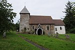
Knowle, Shropshire
Shropshire geography stubsVillages in Shropshire

Knowle is a small village in Shropshire, England. It lies largely in the civil parish of Nash. It is 0.7 miles (1.1 km) south of the larger village of Cleehill (which has a primary school, two pubs and several shops) on the B4214 road to Tenbury Wells.The football club "Clee Hill United" play their home games at Knowle Sports Ground, the highest venue in the Mercian Regional Football League at an elevation of 935–950 feet (285-290m).
Excerpt from the Wikipedia article Knowle, Shropshire (License: CC BY-SA 3.0, Authors, Images).Knowle, Shropshire
Lion Lane,
Geographical coordinates (GPS) Address Nearby Places Show on map
Geographical coordinates (GPS)
| Latitude | Longitude |
|---|---|
| N 52.365 ° | E -2.594 ° |
Address
Lion Lane
Lion Lane
SY8 3NL
England, United Kingdom
Open on Google Maps


