River Huntspill
Canals in SomersetCanals opened in 1940Drainage canals in EnglandGeographic coordinate listsLists of coordinates ... and 4 more
National nature reserves in SomersetParrett catchmentRivers of SomersetSomerset Levels

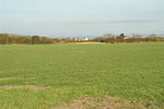
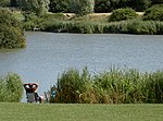
The River Huntspill (or Huntspill River) is an artificial river, in the Somerset Levels, in the Sedgemoor district of Somerset, England. It was built in 1940 to supply process water to ROF Bridgwater, and has resulted in reduced flooding of the lower Brue Valley. Huntspill Sluice at the river's western end, also known as West Huntspill Sluice, separates it from the River Parrett. A large section of the river and its surrounding lands has been designated as a national nature reserve which is managed by the Environment Agency.
Excerpt from the Wikipedia article River Huntspill (License: CC BY-SA 3.0, Authors, Images).River Huntspill
Geographical coordinates (GPS) Address Nearby Places Show on map
Geographical coordinates (GPS)
| Latitude | Longitude |
|---|---|
| N 51.208055555556 ° | E -3.0144444444444 ° |
Address
West Huntspill
, West Huntspill
England, United Kingdom
Open on Google Maps


