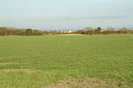
Steart Peninsula

The Steart Peninsula (grid reference ST274459) is a peninsula in Somerset, England. At its outermost tip is Fenning Island (now joined to the mainland), at the tip of which is Stert Point (sometimes spelt Steart Point) which is the eastern end of the West Somerset Coast Path. North of Stert Point lies Stert Island, which was joined to the peninsula until about 1798. The peninsula consists largely of low-lying flat farmland, and projects northwards on the west side of Stockland Reach, the lower stretches of the estuary of the River Parrett. The main settlement on the peninsula is the village of Steart, but two other villages, Stockland Bristol and Otterhampton sit at the peninsula's base. A single minor road links the village of Steart to these other villages. The River Parrett Trail runs along the peninsula. West of the peninsula are the villages of Stolford and Hinkley Point, and to the south is the village of Combwich. From 1927 to the 1950s, Stert Flats, the mudflats north-west of the peninsula, were used as a RAF range, the Stert Flats Air Gunnery and Bombing Range. A few structures from this time remain.
Excerpt from the Wikipedia article Steart Peninsula (License: CC BY-SA 3.0, Authors, Images).Steart Peninsula
Steart Road,
Geographical coordinates (GPS) Address Nearby Places Show on map
Geographical coordinates (GPS)
| Latitude | Longitude |
|---|---|
| N 51.21 ° | E -3.035 ° |
Address
Steart Road
Steart Road
TA5 2PX
England, United Kingdom
Open on Google Maps


