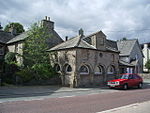
Hardendale
Cumbria geography stubsEden DistrictHamlets in Cumbria

Hardendale is a hamlet in the parish of Shap Rural in the Eden District, in the county of Cumbria, England, near Shap and junction 39 of the M6 motorway. It is also near the hamlet of Oddendale.
Excerpt from the Wikipedia article Hardendale (License: CC BY-SA 3.0, Authors, Images).Hardendale
Geographical coordinates (GPS) Address Nearby Places Show on map
Geographical coordinates (GPS)
| Latitude | Longitude |
|---|---|
| N 54.525 ° | E -2.646 ° |
Address
CA10 3LQ , Shap Rural
England, United Kingdom
Open on Google Maps


