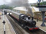
Holcombe, Greater Manchester
Geography of the Metropolitan Borough of BuryRamsbottomVillages in Greater ManchesterWest Pennine Moors

Holcombe is a village in Ramsbottom ward, Metropolitan Borough of Bury, in Greater Manchester, England. It is situated south of Haslingden, east of Edgworth, west of Ramsbottom, and north of Tottington. The name comes from the Celtic cwm meaning valley, and the Old English hol, meaning deep or hollow.
Excerpt from the Wikipedia article Holcombe, Greater Manchester (License: CC BY-SA 3.0, Authors, Images).Holcombe, Greater Manchester
Dundee Lane,
Geographical coordinates (GPS) Address Nearby Places Show on map
Geographical coordinates (GPS)
| Latitude | Longitude |
|---|---|
| N 53.644 ° | E -2.324 ° |
Address
Dundee Lane
Dundee Lane
BL0 9HJ , Nuttall
England, United Kingdom
Open on Google Maps


