Cowie, Stirling

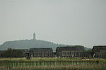
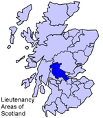
Cowie (Scottish Gaelic: Collaidh, meaning wooded place) is a village in the Stirling council area of Scotland. Historically part of Stirlingshire, it lies on the minor B9124 road approximately 4 miles (6 kilometres) southeast of Stirling and about 1 mile (1.5 kilometres) north of the A9 road. The United Kingdom Census 2011 recorded the population as 2,713.Excavations have identified Mesolithic and Neolithic settlement remains at Chapelfield.Cowie was formerly a pit village and stone quarrying was carried on in the surrounds. It is now the site of a factory manufacturing engineered wood products and other light industries.Recent years have seen significant new housing developments in the village for commuters.
Excerpt from the Wikipedia article Cowie, Stirling (License: CC BY-SA 3.0, Authors, Images).Cowie, Stirling
Alloway Drive,
Geographical coordinates (GPS) Address Nearby Places Show on map
Geographical coordinates (GPS)
| Latitude | Longitude |
|---|---|
| N 56.0805 ° | E -3.867 ° |
Address
Alloway Drive 11
FK7 7BT
Scotland, United Kingdom
Open on Google Maps


