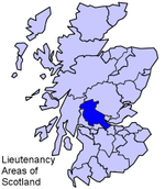
Torwood
Central Scotland geography stubsVillages in Falkirk (council area)

Torwood (Scottish Gaelic: Coille Tor) is a small village located 2 miles (3.2 km) north-northwest of Larbert, 4 miles (6.4 km) north-west of Falkirk and 6 miles (9.7 km) south-southeast of Stirling. Torwood lies within the Falkirk Council area of Scotland. The population recorded in the 2011 UK Census was 245.The A9 road between Bannockburn and Camelon runs through the village. Torwood Has 3 streets: Castle Crescent, Forester Gait & Glen Road. Glen Road leads on to Torwood Castle, Quarry and Broch.
Excerpt from the Wikipedia article Torwood (License: CC BY-SA 3.0, Authors, Images).Torwood
Glen Road,
Geographical coordinates (GPS) Address Nearby Places Show on map
Geographical coordinates (GPS)
| Latitude | Longitude |
|---|---|
| N 56.042 ° | E -3.862 ° |
Address
Glen Road
FK5 4SN
Scotland, United Kingdom
Open on Google Maps


