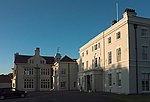
Shardlow

Shardlow is a village in Derbyshire, England about 6 miles (9.7 km) southeast of Derby and 11 miles (18 km) southwest of Nottingham. Part of the civil parish of Shardlow and Great Wilne, and the district of South Derbyshire, it is also very close to the border with Leicestershire, defined by the route of the River Trent which passes close to the south. Just across the Trent is the Castle Donington parish of North West Leicestershire. An important late 18th-century river port for the trans-shipment of goods to and from the River Trent to the Trent and Mersey Canal, during its heyday from the 1770s to the 1840s it became referred to as "Rural Rotterdam" and "Little Liverpool". Today Shardlow is considered Britain's most complete surviving example of a canal village, with over 50 Grade II listed buildings and many surviving public houses within the designated Shardlow Wharf Conservation Area.
Excerpt from the Wikipedia article Shardlow (License: CC BY-SA 3.0, Authors, Images).Shardlow
London Road, South Derbyshire Shardlow and Great Wilne
Geographical coordinates (GPS) Address Nearby Places Show on map
Geographical coordinates (GPS)
| Latitude | Longitude |
|---|---|
| N 52.87 ° | E -1.358 ° |
Address
London Road 74
DE72 2GP South Derbyshire, Shardlow and Great Wilne
England, United Kingdom
Open on Google Maps


