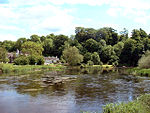
Aston-on-Trent
Civil parishes in DerbyshireOpenDomesdaySouth Derbyshire DistrictVillages in Derbyshire

Aston-on-Trent is a village and civil parish in the South Derbyshire district, in the county of Derbyshire, England. The parish had a population of 1,682 at the 2011 Census. It is adjacent to Weston-on-Trent and near Chellaston, very close to the border with Leicestershire. On the north bank of the River Trent, about a mile from the river on rising ground, it is out of its flood plain. The Trent and Mersey Canal runs between the village and the river. All Saints’ Church is Celtic. There are two public houses, the White Hart and The Malt.
Excerpt from the Wikipedia article Aston-on-Trent (License: CC BY-SA 3.0, Authors, Images).Aston-on-Trent
Shardlow Road, South Derbyshire Aston upon Trent CP
Geographical coordinates (GPS) Address Nearby Places Show on map
Geographical coordinates (GPS)
| Latitude | Longitude |
|---|---|
| N 52.86 ° | E -1.385 ° |
Address
Shardlow Road
DE72 2DH South Derbyshire, Aston upon Trent CP
England, United Kingdom
Open on Google Maps


