Seneca River Crossing Canals Historic District
Canals on the National Register of Historic Places in New York (state)Cayuga County, New York Registered Historic Place stubsErie Canal parks, trails, and historic sitesHistoric districts in Cayuga County, New YorkHistoric districts in Seneca County, New York ... and 5 more
Historic districts on the National Register of Historic Places in New York (state)NRHP infobox with nocatNational Register of Historic Places in Cayuga County, New YorkNational Register of Historic Places in Seneca County, New YorkUse mdy dates from August 2023

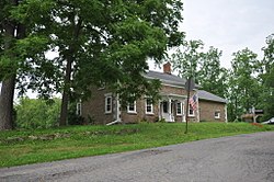
Seneca River Crossing Canals Historic District is a national historic district located at Montezuma and Tyre in Cayuga and Seneca Counties, New York. The district includes more than a mile of the Enlarged Erie Canal prism (built here between 1849 and 1857); towpath and heelpath; a drydock; the remains of the Richmond (Montezuma) Aqueduct crossing the Seneca River; remnants of the original Erie Canal, built between 1817 and 1825 and including Lock #62 and piers of the original mule bridge from that era; and a culvert that carries a stream beneath the Enlarged Erie Canal. It was listed on the National Register of Historic Places in 2005.
Excerpt from the Wikipedia article Seneca River Crossing Canals Historic District (License: CC BY-SA 3.0, Authors, Images).Seneca River Crossing Canals Historic District
Drumlin Trail,
Geographical coordinates (GPS) Address Nearby Places Show on map
 Continue reading on Wikipedia
 Geographical coordinates (GPS)
| Latitude | Longitude |
|---|---|
| N 43.008888888889 ° | E -76.7125 ° |
Address
Drumlin Trail
Drumlin Trail
13117
New York, United States
Open on Google Maps