place

Meyerland, Houston

Jews and Judaism in HoustonNeighborhoods in Houston
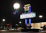
Meyerland plaza green

Meyerland is a community in southwest Houston, Texas, outside of the 610 Loop and inside Beltway 8. The neighborhood is named after the Meyer family, who bought and owned 6,000 acres (24 km2) of land in southwest Houston. Meyerland is the center of Houston's Jewish community; the Meyerland area is the home of Houston's Jewish Community Center, Congregation Beth Israel, Congregation Beth Yeshurun, and several smaller synagogues. The area is also home to Meyerland Plaza, a large outdoor shopping center. Meyerland is partially located within the 100-year floodplain, and houses were prone to flooding during heavy rain events. Meyerland was inundated during Hurricane Harvey in 2017, and stories and images of the flooded community were prominent in media coverage of the natural disaster in Houston.Large scale flood mitigation projects are underway which will greatly benefit Meyerland. Chief amongst such projects is Project Brays, a $400m mega scale flood mitigation project which will remove several Meyerland homes from 100 year flood plain. Circa 2018 several new homes are being built in Meyerland and the neighborhood is seeing strong new home construction. Luxury homes over $1m in value are being built several feet above the minimum base flood elevation.

Excerpt from the Wikipedia article Meyerland, Houston (License: CC BY-SA 3.0, Authors, Images).

Meyerland, Houston
South Rice Avenue, Houston Meyerland

Geographical coordinates (GPS) Address Nearby Places
placeShow on map

Wikipedia: Meyerland, HoustonContinue reading on Wikipedia

Geographical coordinates (GPS)

Latitude Longitude
N 29.685 ° E -95.4674 °
placeShow on map

Address

South Rice Avenue

South Rice Avenue
77096 Houston, Meyerland
Texas, United States
mapOpen on Google Maps

Meyerland plaza green
Share experience

Nearby Places

Bellaire Boulevard
Bellaire Boulevard

Bellaire Boulevard (also known as Holcombe, and as 百利大道 Bǎilì Dàdào in Chinese and Đại Lộ Sàigòn in Vietnamese) is an arterial road in western Houston, Texas, United States. The street also goes through unincorporated areas in Harris County and the cities of Bellaire, Southside Place, and West University Place. Bellaire Boulevard goes through or next to the Houston communities of Alief, Chinatown, Gulfton, and Sharpstown. In addition the boulevard goes through the Greater Sharpstown management district. John Nova Lomax of the Houston Press described Bellaire Boulevard as "a world market of a street, a bazaar where Mexicans, Anglos, Salvadorans, African Americans, Hondurans, stoners, Vietnamese, Chinese, Filipinos, Japanese, Koreans and Thais go to shop and eat." The street ends at Holcombe Boulevard, which extends to the Texas Medical Center.As of 2005 many Salvadoran immigrants live and work along the portion of Bellaire Boulevard in the Gulfton area. Many Asian American businesses populate the sections of Bellaire Boulevard in Alief and Chinatown.From west to east, the east segment begins west of Westmoor Drive in Richmond and concludes at Edloe Street in Southside Place where it changes into Holcombe Blvd. It is 16.7 miles long. The western segment is 6.2 miles long, beginning (from east to west) at Harlem Road in Richmond and concluding at FM 723 where it becomes Fulshear-Gaston Road. The two segments together run for 22.9 miles. A proposed extension would combine the two segments into one.