place

Tybee National Wildlife Refuge

IUCN Category IVLandforms of Jasper County, South CarolinaNational Wildlife Refuges in South CarolinaProtected areas established in 1938Protected areas of Jasper County, South Carolina
Wetlands of South Carolina

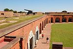
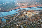
Tybee National Wildlife Refuge was established on May 9, 1938, by an executive order of President Franklin D. Roosevelt, as a breeding area for migratory birds and other wildlife. Located in the mouth of the Savannah River, the 100-acre (0.40 km2) refuge began as a 1-acre (4,000 m2) oyster shoal, Oysterbed Island, used by the U.S. Army Corps of Engineers as a spoil disposal site to support their mandated harbor dredging activity. As a result, the majority of the refuge is now covered with sand deposits. The more stable portions of the island are densely covered with such woody species as eastern red cedar, wax myrtle, and groundsel. saltwater marsh borders parts of the island. The refuge is an important resting and feeding area for migratory birds including gulls, terns, neotropical migratory songbirds, and shorebirds. Least terns, black skimmers, Wilson's plovers, and several other shorebird species have nested on the spoil deposits on Tybee. During all seasons, the refuge's shoreline and open spoil deposits are used as resting sites for brown pelicans, gulls, and terns. Endangered species, including piping plovers and wood storks, have been observed on the refuge land, while shortnose sturgeon and manatees have been found in the waters bordering Tybee. With the use of telescopes, birdwatchers observe the refuge birdlife from levees located across the river within Fort Pulaski National Monument.

Excerpt from the Wikipedia article Tybee National Wildlife Refuge (License: CC BY-SA 3.0, Authors).

Tybee National Wildlife Refuge
McQueen's Island Historic Trail,

Geographical coordinates (GPS) Address Nearby Places
placeShow on map

Wikipedia: Tybee National Wildlife RefugeContinue reading on Wikipedia

Geographical coordinates (GPS)

Latitude Longitude
N 32.04187 ° E -80.91649 °
placeShow on map

Address

Tybee National Wildlife Refuge

McQueen's Island Historic Trail
31410
Georgia, United States
mapOpen on Google Maps

Share experience

Nearby Places

Siege of Fort Pulaski

The siege of Fort Pulaski (or the Siege and Reduction of Fort Pulaski) concluded with the Battle of Fort Pulaski fought April 10–11, 1862, during the American Civil War. Union forces on Tybee Island and naval operations conducted a 112-day siege, then captured the Confederate-held Fort Pulaski after a 30-hour bombardment. The siege and battle are important for innovative use of rifled guns which made existing coastal defenses obsolete. The Union initiated large-scale amphibious operations under fire. The fort's surrender strategically closed Savannah as a port. The Union extended its blockade and aids to navigation down the Atlantic coast, then redeployed most of its 10,000 troops. The Confederate army-navy defense blocked Federal advance for over three months, secured the city, and prevented any subsequent Union advance from seaward during the war. Coastal rail connections were extended to blockaded Charleston, South Carolina. Fort Pulaski is located on Cockspur Island, Georgia, near the mouth of the Savannah River. The fort commanded seaward approaches to the City of Savannah. The city was commercially and industrially important as a cotton exporting port, railroad center and the largest manufacturing center in the state, including a state arsenal and private shipyards. Two southerly estuaries led to the Savannah River behind the fort. Immediately east of Pulaski, and in sight of Hilton Head Island, South Carolina, lay Tybee Island with a lighthouse station.

Jasper Ocean Terminal

The Jasper Ocean Terminal (JOT) is a planned deepwater container port that will be built in South Carolina on the Savannah River, about 10 miles (16 km) downstream from Savannah, Georgia. JOT is planned to open between 2035 and 2037. The terminal was originally planned because additional capacity was needed by both the Georgia Ports Authority (GPA) and the South Carolina Ports Authority (SCPA). However, the SCPA transferred its half-interest in the property to Jasper County in 2021. The GPA has until September, 2021, to state whether it will develop the port with Jasper County officials. The SCPA cited differing markets as the main cause for pulling out of the deal. The project has been in various stages of planning since 2007 and in 2008 the GPA and SCPA signed an early agreement to jointly build and operate the facility. However, political tensions regarding plans to dredge the river slowed progress, and little money was invested—by 2016 only about $10 million had spent on planning and permits. In November 2015, the ports authorities signed an updated agreement to develop the terminal, and in late 2016 a new round of design work began, with an estimated $100 million cost. In January 2017, the Army Corps of Engineers began the environmental impact statement for the dockside portion of Jasper Terminal. The total cost of building the port is estimated at $4.5 billion.At full build-out, JOT will cover 1,500 acres, with ten berths. It will be dredged to a 55 feet (17 m) depth, able to accommodate ships carrying as many as 20,000 TEU containers, with an annual capacity of seven million TEUs. Access to the facility will be via a new four lane highway connecting to US Route 17, and rail connections to both CSX Transportation and Norfolk Southern Railway lines.