place

Assabet River National Wildlife Refuge

2005 establishments in MassachusettsIUCN Category IVInstallations of the U.S. Army in MassachusettsLandforms of Middlesex County, MassachusettsMilitary Superfund sites
National Wildlife Refuges in MassachusettsProtected areas established in 2005Protected areas of Middlesex County, MassachusettsSudbury, MassachusettsSuperfund sites in MassachusettsWetlands of Massachusetts
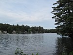
Puffer Pond, Assabet River National Wildlife Refuge, Maynard MA

The Assabet River National Wildlife Refuge (ARNWR; formerly referred to as the U.S. Army's Fort Devens-Sudbury Training Annex) is a 2,230-acre (9.0 km2) protected National Wildlife Refuge located approximately 25 miles (40 km) west of Boston and 4 miles (6.4 km) west of the Eastern Massachusetts National Wildlife Refuge Complex Headquarters, along the Assabet River. It is located in portions of the towns of Hudson, Maynard, Stow and Sudbury. The Assabet River National Wildlife Refuge consists of two separate pieces of land. The larger northern section is just north of Hudson Road, extending north to the Assabet River. The southern section is located to the south of Hudson Road. There is a visitor center located in the northern section on Winterberry Way.

Excerpt from the Wikipedia article Assabet River National Wildlife Refuge (License: CC BY-SA 3.0, Authors, Images).

Assabet River National Wildlife Refuge
Blue,

Geographical coordinates (GPS) Address Nearby Places
placeShow on map

Wikipedia: Assabet River National Wildlife RefugeContinue reading on Wikipedia

Geographical coordinates (GPS)

Latitude Longitude
N 42.408333333333 ° E -71.470555555556 °
placeShow on map

Address

Assabet National Wildlife Refuge

Blue
01775
Massachusetts, United States
mapOpen on Google Maps

Puffer Pond, Assabet River National Wildlife Refuge, Maynard MA
Share experience

Nearby Places

Lake Boon
Lake Boon

Lake Boon is a lake in eastern Massachusetts covering about 163 acres (66 ha) in the towns of Stow and Hudson, Massachusetts. The lake is approximately 1.5 miles (2.4 km) long and consists of four basins connected by narrows. The first and largest basin at the north-west end of the lake stretches from a dam along Barton Road in Stow down to narrows just above the towns south border. It is the only part of the lake that is completely within Stow. The second basin is about half the size of the first and straddles the border with Hudson. The 3rd and 4th basins at the eastern end of the lake are much smaller and less easily navigable due to shallow waters and significant plant-growth. Maximum depth of the first basin is approximately 23 ft (7.0 m), making it the deepest part of the lake. At their deepest points the second basin is about 10 ft (3.0 m), the third basin is about 7 ft (2.1 m), and the fourth basin is only 4 ft (1.2 m) deep.Lake Boon serves as an important part of the Stow and Hudson communities, with residences built around most of the shoreline. There is one semi-public beach, Pine Bluffs, located in Stow on the north-east edge of first basin. In the summer it provides a place for camps and swim lessons and has a few basic amenities like picnic tables and grills. Use of the Pine Bluff Beach requires either a day-pass which can only be purchased by local residents or a season-pass that is available to the wider public.

Presidential Village, Maynard, Massachusetts

Presidential Village (also once known as New Village, Reardonville, and Mahoneyville) is a residential neighborhood of approximately 250 houses in Maynard, Massachusetts, where almost all of the streets are named after the post-American Civil War U.S. Presidents: Ulysses Grant, Rutherford Hayes, James Garfield, Chester Arthur, Grover Cleveland, Benjamin Harrison, William McKinley, and Theodore Roosevelt. Across from Harrison Street is the Coolidge Park Playground and former Calvin Coolidge School (1905), named after President Calvin Coolidge in 1932.The American Woolen Company started construction of the neighborhood in 1902 as rented mill worker housing - small houses on small lots. The mill owned the housing until August 1934 when it put 101 houses and 49 two-family dwellings up for auction. The single-family houses sold for about $1100 to $1400. The neighborhood remains largely preserved in its original form. Prior to the construction the land had been farmland belonging to the Reardon and Mahoney families.According to a Boston Globe newspaper article at the time, New Village was a "model village," and a great improvement over the many factory sponsored housing projects that the newspaper described as "barracks-like rows of apartment houses." Houses in New Village, by contrast, varied by style of architecture. Each house was freestanding with sufficient space for a garden and trees. Furthermore, while all of Maynard enjoyed a public water system in the early 1900s, New Village was the only neighborhood in Maynard that had sewers. In the assessment of the Boston Globe, "....there probably is not today anywhere in New England a similar number of houses designed for occupancy of mill employes(sic) equal in all respects to these."The Town of Maynard Historical Commission has created six self-guided historic walking tours. Tour #3 visits New Village: "Thirteen different styles of houses were built and are designated as Types A-M. The village was built on the old Mahoney and Reardon farms and boasted a private sewer system. Each house had pine flooring, a cold water tap, a toilet in the cellar, and no central heat. Houses were rented to mill employees for $3-6 per month."