Varennes, Winnipeg
Manitoba geography stubsNeighbourhoods in WinnipegSt. Vital, Winnipeg

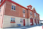
Varennes is a neighbourhood in the city of Winnipeg, Manitoba, Canada, located in the northern section of the district of St. Vital. It is a small triangular neighbourhood located, and is bounded by St. Mary's Road on the west, Fermor Avenue on the south, and St. Anne's Road (Trans-Canada Highway) on the east. In the 2001 census, Varennes had a population of 1,080.The neighbourhood was named for Pierre Gaultier de Varennes, sieur de La Vérendrye, an early French explorer in the district. It is in the federal riding of Saint Boniface—Saint Vital and the provincial riding of St. Vital.
Excerpt from the Wikipedia article Varennes, Winnipeg (License: CC BY-SA 3.0, Authors, Images).Varennes, Winnipeg
Saint Mary’s Road, Winnipeg
Geographical coordinates (GPS) Address Nearby Places Show on map
 Continue reading on Wikipedia
 Geographical coordinates (GPS)
| Latitude | Longitude |
|---|---|
| N 49.855 ° | E -97.112 ° |
Address
Saint Mary's Road
Saint Mary’s Road
R2M 3L5 Winnipeg
Manitoba, Canada
Open on Google Maps