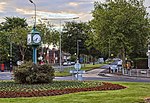
Skidby
Civil parishes in the East Riding of YorkshireGeographic coordinate listsLists of coordinatesOpenDomesdayUse British English from June 2015 ... and 1 more
Villages in the East Riding of Yorkshire

Skidby is a small village and civil parish in Yorkshire Wolds of the East Riding of Yorkshire, England. It is situated about 6 miles (10 km) north-west of Hull city centre, 2.2 miles (3.5 km) west of Cottingham and 5 miles (8 km) south of Beverley. The civil parish contains mainly agricultural land, both in the hills of the wolds and the low-lying land. The civil parish also includes the hamlets of Eppleworth and Raywell. The village is the site of Skidby Windmill, a Grade II* listed building.
Excerpt from the Wikipedia article Skidby (License: CC BY-SA 3.0, Authors, Images).Skidby
Chapel Close,
Geographical coordinates (GPS) Address Nearby Places Show on map
Geographical coordinates (GPS)
| Latitude | Longitude |
|---|---|
| N 53.7894 ° | E -0.46134 ° |
Address
Chapel Close
HU16 5TJ , Skidby
England, United Kingdom
Open on Google Maps


