Haltemprice
Geography of the East Riding of YorkshireUse British English from February 2020
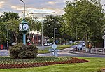
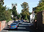
Haltemprice is an area in the East Riding of Yorkshire, England, directly to the west of Hull. Originally an extra-parochial area, it became a civil parish in 1858, in 1935 it was expanded by the combination of the urban districts of Cottingham, Anlaby, and Sculcoates to form a new urban district; the district included the villages of Anlaby, Cottingham, Hessle, Kirk Ella, Skidby, West Ella and Willerby. Urban districts were abolished 1974. As of 2012 Haltemprice gives its name to the Haltemprice and Howden (UK Parliament constituency), and the East Riding of Yorkshire Council run 'Haltemprice Leisure Centre' in Anlaby.
Excerpt from the Wikipedia article Haltemprice (License: CC BY-SA 3.0, Authors).Haltemprice
Well Lane,
Geographical coordinates (GPS) Address Nearby Places Show on map
Geographical coordinates (GPS)
| Latitude | Longitude |
|---|---|
| N 53.764 ° | E -0.439 ° |
Address
Well Lane
Well Lane
HU10 6HT
England, United Kingdom
Open on Google Maps


