Sigford
DartmoorDevon geography stubsHamlets in Devon

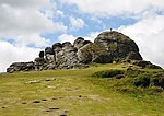
Sigford is a small hamlet in the Parish of Ilsington, on the eastern edge of Dartmoor, Devon, England. It is situated at the confluence of three rivers, although the name of the settlement refers to just one of these, the River Sig. The other two rivers are the Lemon and Langworthy Brook. Upstream from Sigford on Langworthy Brook are a number of old arsenic and tin mines, and at times the river water can appear bright red.
Excerpt from the Wikipedia article Sigford (License: CC BY-SA 3.0, Authors, Images).Sigford
Teignbridge Ilsington
Geographical coordinates (GPS) Address Nearby Places Show on map
Geographical coordinates (GPS)
| Latitude | Longitude |
|---|---|
| N 50.551111111111 ° | E -3.7283333333333 ° |
Address
TQ12 6LF Teignbridge, Ilsington
England, United Kingdom
Open on Google Maps


