Carlungie and Ardestie earthhouses
Archaeological sites in Angus, ScotlandIron Age sites in ScotlandScheduled Ancient Monuments in Angus
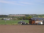
Carlungie and Ardestie Earthhouses can be found in farmland north of Monifieth and Carnoustie. They date to the late Iron Age, from the 1st to 2nd centuries AD. They are examples of souterrains, probably used to store food.
Excerpt from the Wikipedia article Carlungie and Ardestie earthhouses (License: CC BY-SA 3.0, Authors).Carlungie and Ardestie earthhouses
Core Path,
Geographical coordinates (GPS) Address External links Nearby Places Show on map
Geographical coordinates (GPS)
| Latitude | Longitude |
|---|---|
| N 56.513333333333 ° | E -2.7958333333333 ° |
Address
Carlungie Earth House
Core Path
DD5 3PY
Scotland, United Kingdom
Open on Google Maps


