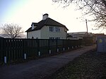
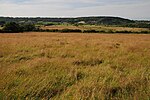
Clapton in Gordano
Civil parishes in SomersetUse British English from July 2012Villages in North Somerset

Clapton in Gordano is a village and civil parish in Somerset, England. It is situated within the unitary authority of North Somerset on the southern side of the Gordano Valley, immediately adjacent to the M5 motorway. The parish has a population of 348. There is a village football club, Clapton in Gordano FC. They currently run two sides with a view to continue progressing throughout the leagues. Their home ground is currently Clapton Lane, Portishead.
Excerpt from the Wikipedia article Clapton in Gordano (License: CC BY-SA 3.0, Authors, Images).Clapton in Gordano
Causeway,
Geographical coordinates (GPS) Address Nearby Places Show on map
Geographical coordinates (GPS)
| Latitude | Longitude |
|---|---|
| N 51.462 ° | E -2.758 ° |
Address
Causeway
Causeway
BS20 7RR
England, United Kingdom
Open on Google Maps


