Morton Bagot

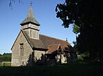
Morton Bagot is a small village in the Stratford-on-Avon District of Warwickshire, England. It lies about 1.5 miles (2 km) east of the Birmingham-Alcester road, the modern A435 and Roman road Ryknild Street, 6.5 miles (10 km) north of Alcester, 9.5 miles (15 km) from Stratford-upon-Avon and 12 miles from Warwick, across the valley of a small brook, flowing south-east to join the River Arrow. A road from Oldberrow to Spernall runs north and south through the middle of the parish of Morton Bagot, Oldberrow and Spernall, past the church. The elevation varies from 200 feet (61 m) to 400 feet (120 m), the highest point being at Bannum's Wood. There is no main village and there has been considerable depopulation here since the 18th century. In the 2001 Census the whole parish had a population of 153.
Excerpt from the Wikipedia article Morton Bagot (License: CC BY-SA 3.0, Authors, Images).Morton Bagot
Stratford-on-Avon
Geographical coordinates (GPS) Address Nearby Places Show on map
Geographical coordinates (GPS)
| Latitude | Longitude |
|---|---|
| N 52.28118 ° | E -1.83652 ° |
Address
B80 7EH Stratford-on-Avon
England, United Kingdom
Open on Google Maps


