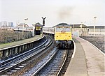
Collyhurst
Areas of Manchester

Collyhurst is an inner city area of Manchester, England, 1.5 miles (2.4 km) northeast of the city centre on Rochdale Road (A664) and Oldham Road (A62), bounded by Smedley, Harpurhey and Monsall to the north, Miles Platting to the east, Ancoats to the south, and the River Irk to the west. Prominent buildings include two Roman Catholic churches, St Patrick's and St Malachy's.
Excerpt from the Wikipedia article Collyhurst (License: CC BY-SA 3.0, Authors, Images).Collyhurst
Kelly Street, Manchester Collyhurst
Geographical coordinates (GPS) Address Nearby Places Show on map
Geographical coordinates (GPS)
| Latitude | Longitude |
|---|---|
| N 53.496703 ° | E -2.217846 ° |
Address
Kelly Street
Kelly Street
M40 8NL Manchester, Collyhurst
England, United Kingdom
Open on Google Maps


