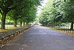
Northern Moor

Northern Moor is an area of Manchester, England, north of Baguley, west of Northenden and east of Sale, 5 miles south of Manchester city centre. The Tatton family lived from 1540 to 1926 at Wythenshawe Hall in Northern Moor; land around it is now Wythenshawe Park, which was a deer park from 1200 to 1540. In former centuries it was spelt "Northen Moor" and meant "the moor area belonging to Northenden". Until 1931, Northern Moor was part of Cheshire, before Manchester expanded south of the River Mersey and its borders were changed to include Northern Moor and Northenden. The area includes Lawton Moor, and the northern border is now with Sale Moor. The area has grown since the 1930s and 1940s to cover the area of the old Tatton family estate and farms. In 1926, Mr.Tatton (country squire at Wythenshawe Hall) sold land in Wythenshawe, and it came into the hands of Manchester Corporation, which chose four farm fields in Northern Moor to be the Manchester (Wythenshawe) Aerodrome. Its runway opened in early 1929, with the old farm house used for offices. The airfield closed a few years later, moved to Eccles and became Barton Airport. The land was redeveloped with Rackhouse School opening in 1935, St. Michael's Church in 1937, St Aidan's Catholic School in 1938, and houses built in the 1930s and 1940s on the land. Northern Moor has grown further since, expanding to the Sale border. The Kerscott estate was a fruit farm with apple and plum trees. The area is now part of the Wythenshawe and Sale East Parliament constituency.
Excerpt from the Wikipedia article Northern Moor (License: CC BY-SA 3.0, Authors, Images).Northern Moor
Shevington Gardens, Manchester Northern Moor
Geographical coordinates (GPS) Address Nearby Places Show on map
Geographical coordinates (GPS)
| Latitude | Longitude |
|---|---|
| N 53.41 ° | E -2.27 ° |
Address
The Manchester College, Northenden Campus
Shevington Gardens
M23 0BJ Manchester, Northern Moor
England, United Kingdom
Open on Google Maps


