Solling

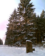
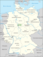
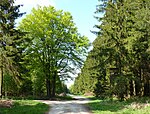
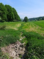
The Solling () is a range of hills up to 527.8 m above sea level (NN) high in the Weser Uplands in the German state of Lower Saxony, whose extreme southerly foothills extend into Hesse and North Rhine-Westphalia. Inside Lower Saxony it is the second largest range of hills and the third highest after the Harz (Wurmberg; 971 m) and the Kaufungen Forest (Haferberg; 581 m). The Solling is a cultural landscape consisting mainly of spruce and beech forests. Oak also grows in some areas. The Solling forest is home of a number of animals and birds, for example red deer or chaffinch. They can best be observed in the Neuhaus wildlife park. Together with the smaller and lower Vogler range and the little Burgberg to the north, the Solling is part of the Solling-Vogler Nature Park.
Excerpt from the Wikipedia article Solling (License: CC BY-SA 3.0, Authors, Images).Solling
Lakenstraße, Solling
Geographical coordinates (GPS) Address Nearby Places Show on map
Geographical coordinates (GPS)
| Latitude | Longitude |
|---|---|
| N 51.733333333333 ° | E 9.6 ° |
Address
Lakenstraße
Lakenstraße
37586 Solling
Lower Saxony, Germany
Open on Google Maps
