Hilmersberg
Hills of Lower SaxonyLower Saxony geography stubs
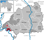
The Hilmersberg is a hill, 362 metres above sea level in the Solling, a hill range in the German state of Lower Saxony. It lies west of Kammerborn and east of Polier, part of the borough of Bodenfelde in the Solling-Vogler Nature Park.
Excerpt from the Wikipedia article Hilmersberg (License: CC BY-SA 3.0, Authors).Hilmersberg
Im Trockenen Siek,
Geographical coordinates (GPS) Address Nearby Places Show on map
Geographical coordinates (GPS)
| Latitude | Longitude |
|---|---|
| N 51.6735 ° | E 9.56 ° |
Address
Im Trockenen Siek
37170
Lower Saxony, Germany
Open on Google Maps


