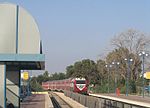
Sarafand al-Kharab
Arab villages depopulated during the 1948 Arab–Israeli WarDistrict of RamlaPages with non-numeric formatnum arguments

Sarafand al-Kharab (Arabic: صرفند الخراب) was a Palestinian Arab village in the Ramle Subdistrict, located 50 meters (160 ft) above sea level, 7 kilometers (4.3 mi) west of Ramla, in the area that is today northeast of Ness Ziona.
Excerpt from the Wikipedia article Sarafand al-Kharab (License: CC BY-SA 3.0, Authors, Images).Sarafand al-Kharab
Meir Herman,
Geographical coordinates (GPS) Address Phone number Nearby Places Show on map
Geographical coordinates (GPS)
| Latitude | Longitude |
|---|---|
| N 31.936388888889 ° | E 34.805555555556 ° |
Address
בית
Meir Herman 11
7401421
Center District, Israel
Open on Google Maps


