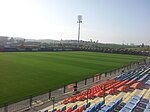
Al-Qubayba, Ramle
Arab villages depopulated during the 1948 Arab–Israeli WarDistrict of RamlaPages with non-numeric formatnum arguments

Al-Qubayba (Arabic: القبيبة) was a Palestinian Arab village in the Ramle Subdistrict. It was depopulated during the 1948 Arab-Israeli War on May 27, 1948, by the Givati Brigade as part of the Second stage of Operation Barak. It was located 10.5 km southeast of Ramla near the Rubin River (or Wadi al-Sarar) which provided the village with water and irrigation for agriculture. Al-Qubayba was mostly destroyed with the exception of a few houses, and Kfar Gevirol was built in its place, now a suburb in the west of Rehovot.
Excerpt from the Wikipedia article Al-Qubayba, Ramle (License: CC BY-SA 3.0, Authors, Images).Al-Qubayba, Ramle
HaDolev,
Geographical coordinates (GPS) Address Nearby Places Show on map
Geographical coordinates (GPS)
| Latitude | Longitude |
|---|---|
| N 31.894722222222 ° | E 34.771388888889 ° |
Address
הדולב
HaDolev
7627603
Center District, Israel
Open on Google Maps


