Dayr al-Shaykh
Arab villages depopulated during the 1948 Arab–Israeli WarDistrict of JerusalemIslamic shrines in IsraelPages with non-numeric formatnum arguments

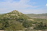
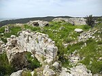
Dayr al-Shaykh (Arabic: دير الشيخ), also spelt Deir esh Sheikh, was a Palestinian Arab village in the Jerusalem Subdistrict, also known as the Jerusalem corridor. It was depopulated during the 1948 Arab-Israeli War. The village was located 16 kilometers (9.9 mi) west of Jerusalem.
Excerpt from the Wikipedia article Dayr al-Shaykh (License: CC BY-SA 3.0, Authors, Images).Dayr al-Shaykh
3866, Mate Yehuda Regional Council
Geographical coordinates (GPS) Address Website External links Nearby Places Show on map
Geographical coordinates (GPS)
| Latitude | Longitude |
|---|---|
| N 31.748888888889 ° | E 35.067222222222 ° |
Address
دير الشيخ
3866
9987500 Mate Yehuda Regional Council
Jerusalem District, Israel
Open on Google Maps


