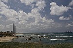
Arab al-Fuqara
Arab villages depopulated prior to the 1948 Arab–Israeli WarDistrict of HaifaPages with non-numeric formatnum arguments

Arab al-Fuqara (Arabic: عرب الفقراء) was a Palestinian Arab village in the Haifa Subdistrict. It was depopulated during the 1947–1948 Civil War in Mandatory Palestine on April 10, 1948. At that time, the land records of the village consisted of a total area of 2,714 dunams, of which 2,513 were owned by Jews, 15 owned by Arabs, and the remaining 186 dunams being public lands.
Excerpt from the Wikipedia article Arab al-Fuqara (License: CC BY-SA 3.0, Authors, Images).Arab al-Fuqara
Ofira, Hadera Neve Hayyim
Geographical coordinates (GPS) Address Nearby Places Show on map
Geographical coordinates (GPS)
| Latitude | Longitude |
|---|---|
| N 32.452222222222 ° | E 34.905833333333 ° |
Address
אופירה
Ofira
3844415 Hadera, Neve Hayyim
Haifa District, Israel
Open on Google Maps


