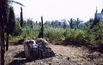
Motul de San José is an ancient Maya site (known anciently as Ik'a', 'Windy Water') located just north of Lake Petén Itzá in the Petén Basin region of the southern Maya lowlands. It is a few kilometres from the modern village of San José, in Guatemala's northern department of Petén. A medium-sized civic-ceremonial centre, it was an important political and economic centre during the Late Classic period (AD 650–950).
The site was first settled between 600 and 300 BC, in the latter portion of the Middle Preclassic period, when it most likely was a fairly small site. This Maya city then had a long and continuous occupational history until the Early Postclassic, up to around AD 1250, with peaks in the Late Preclassic and Late Classic periods. Motul de San José had begun to refer to Tikal as its overlord in the late 4th century AD; by the 7th century it had switched its allegiance to Calakmul, Tikal's great rival, before returning its allegiance to Tikal in the early 8th century. In the late 8th century Motul de San José appears to have been conquered by Dos Pilas, capital of the Petexbatún kingdom.
Most natural resources were easily available in the immediate vicinity of the city. The nearby port at La Trinidad de Nosotros was an important hub for the import of exotic goods and export of local products such as chert and ceramics. Other goods not immediately available were likely to have been provided by the city's satellite sites. The local area provided a number of different soils suitable for varied agricultural use, and the port at La Trinidad de Nosotros provided the city with freshwater products such as turtles, crocodiles and freshwater molluscs. Deer were hunted locally and provided an important source of protein for the upper class, while freshwater snails were the main source of protein for commoners.
Motul de San José has been identified as the source of Ik-style polychrome ceramics bearing painted scenes of the Late Classic Maya aristocracy involved in a variety of courtly activities. The Ik-style was characterised by hieroglyphs painted in a pink or pale red colour, scenes with dancers wearing masks, and the realistic representation of subjects as they appeared in life. The city was the capital of a polity that included various satellite sites of varying importance, including a port on the shore of Lake Petén Itzá.
 Continue reading on Wikipedia