place

Love Park

Center City, PhiladelphiaLoveMunicipal parks in PhiladelphiaSkateboarding spotsUse mdy dates from October 2020
LOVE Park Philly
LOVE Park Philly

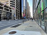
LOVE Park, officially known as John F. Kennedy Plaza, is a public park located in Center City, Philadelphia, Pennsylvania. The park is nicknamed LOVE Park for its reproduction of Robert Indiana's 1970 LOVE sculpture which overlooks the plaza. The area has a following in the skate world, as it served as a skateboarding spot for many years.

Excerpt from the Wikipedia article Love Park (License: CC BY-SA 3.0, Authors, Images).

Love Park
Underground Concourse, Philadelphia Center City

Geographical coordinates (GPS) Address Nearby Places
placeShow on map

Wikipedia: Love ParkContinue reading on Wikipedia

Geographical coordinates (GPS)

Latitude Longitude
N 39.9542 ° E -75.1657 °
placeShow on map

Address

Suburban Station

Underground Concourse
19103 Philadelphia, Center City
Pennsylvania, United States
mapOpen on Google Maps

LOVE Park Philly
LOVE Park Philly
Share experience

Nearby Places

Race Street Friends Meetinghouse

The Race Street Meetinghouse is an historic and still active Quaker meetinghouse at 1515 Cherry Street at the corner of N. 15th Street in the Center City area of Philadelphia, Pennsylvania. The meetinghouse served as the site of the Yearly Meeting of the Hicksite sect of the Religious Society of Friends (Quakers) from 1857 to 1955. Built in 1856 by the Philadelphia Yearly Meeting and what is now known as Central Philadelphia Monthly Meeting, a building 131 feet long by 80 feet wide was set fairly close to its Cherry Street frontage but sufficiently far back from Race Street to provide a pleasant open yard. The structure built was not just one meeting house, but two, so arranged and divided that either party could dispose of its property without affecting the property of the other. Construction brought two meeting rooms 36 feet high, the northern chamber being 60 feet by 80; the southern, 46 by 80. Each had "youth's galleries" on three sides. Between the two meetinghouses, and exceeding them by 16 feet in total width, was a 25-by-96-foot three-story structure containing large rooms for committee meetings and other purposes.The Race Street Meetinghouse was at the forefront of women's involvement both in Quaker religion and in American political activism. Many leaders in the Women's Movement were associated with this meetinghouse; these included abolitionist and women's rights activist Lucretia Mott, peace activist Hannah Clothier Hull, and suffrage leader and Equal Rights Amendment author Alice Paul.The meetinghouse was designated a National Historic Landmark in 1993 for its role in the abolition of slavery, the advancement of women's suffrage, and the civil rights movement.The Meetinghouse is part of the Friends Center campus, which includes the National Office of the American Friends Service Committee, Friends World Committee for Consultation, Philadelphia Yearly Meeting, and the Greater Philadelphia Chapter of the United Nations Association. It is the site of a copy of Sylvia Shaw Judson's statue of Mary Dyer, the 17th-century Quaker martyr. The Friends Meeting Center, built in 1974, was designed by Cope & Lippincott.

Market Street (Philadelphia)

Market Street, originally known as High Street, is a major east–west street in Philadelphia. The street is signed as Pennsylvania Route 3 between 38th Street (U.S. Route 13) and 15th Street (PA 611). A short portion of the road continues west from Cobbs Creek Parkway (63rd Street) to Delaware County, adjacent to Philadelphia. ‘High Street’ was the familiar name of the principal street in nearly every English town at the time Philadelphia was founded. But if Philadelphia was indebted to England for the name of High Street, nearly every American town is, in turn, indebted to Philadelphia for its Market Street. Long before the city was laid out or settled, Philadelphia's founder, William Penn, had planned that markets would be held regularly on the 100-foot (30 m) wide High Street. The city's first market stalls were situated in the center of the thoroughfare starting at Front Street and proceeding west eventually to 8th Street. The stalls soon became covered and were not taken down as planned. Later, additional covered sheds appeared west of Center Square as the city expanded westward. The street began to be called Market Street around 1800. The road's new name was made official by an ordinance of 1858, coincidentally, just a year before the market sheds were ordered removed. Market Street has been called the most historic highway in the United States because of the various historic sites along its eastern section. Many of Benjamin Franklin's activities were centered along Market Street. His house was located near the intersection of Fourth Street, and he may have performed his famous kite-flying experiment near Third and Market Streets. Thomas Jefferson wrote the Declaration of Independence in a boarding house (the Graff or Declaration House) once located at the Seventh Street intersection. The mansion of Robert Morris, financier of the American Revolution, was located near Sixth and Market Streets. This house, known as the President's House, was used by George Washington and John Adams as their residence during their terms as president. (The house was more or less on the site of the northern part of the modern-day Liberty Bell Center.) Around 1795 Theophilus Cazenove lived at Market Street. Several important finance and publishing firsts also occurred along Market Street between Second and Fourth Streets during the 18th century. Market Street is still one of the principal locations of business and commerce in Philadelphia. On June 5, 2013, a building collapsed at 22nd Street, trapping a number of people under the rubble. Six people died and fourteen others were injured. The location of the accident has been dedicated as a memorial for the victims.