place

Large Stone Structure (Bronze Age Jerusalem)

2005 archaeological discoveriesAll accuracy disputesAncient sites in JerusalemArchaeological discoveries in IsraelArchaeological discoveries in the West Bank
Buildings and structures completed in the 10th century BCBuildings and structures completed in the 9th century BCCity of David (archaeological site)Forts in IsraelKingdom of Israel (united monarchy)Palaces in IsraelSilwanStone buildings
KDP IMG 4885
KDP IMG 4885

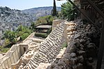
The Large Stone Structure (Hebrew: מבנה האבן הגדול Mivne haEven haGadol) is the name given to a set of remains interpreted by the excavator, Israeli archaeologist Eilat Mazar, as being part of a single large public building in the City of David, presumably the oldest settlement core of Jerusalem. Mazar tentatively dated the findings to the tenth to ninth century BCE. Mazar chose this particular name for the alleged structure because of its proximity to another site known as the Stepped Stone Structure. Mazar announced the discovery on 4 August 2005, and stated that she believed it may be the remains of King David's palace as recorded in the Books of Samuel. The interpretation of the remains as those of one single building, the suggested date, and the association with King David have all been challenged by other well-known archaeologists. The archaeological dig was funded privately by Roger Hertog, an American banker.

Excerpt from the Wikipedia article Large Stone Structure (Bronze Age Jerusalem) (License: CC BY-SA 3.0, Authors, Images).

Large Stone Structure (Bronze Age Jerusalem)
Wadi Hilwa, Jerusalem Abu Tor

Geographical coordinates (GPS) Address Nearby Places
placeShow on map

Wikipedia: Large Stone Structure (Bronze Age Jerusalem)Continue reading on Wikipedia

Geographical coordinates (GPS)

Latitude Longitude
N 31.774246 ° E 35.235777 °
placeShow on map

Address

Wadi Hilwa
9114001 Jerusalem, Abu Tor
Jerusalem District, Israel
mapOpen on Google Maps

KDP IMG 4885
KDP IMG 4885
Share experience

Nearby Places

City of David (archaeological site)

The City of David (Hebrew: עיר דוד, romanized: Īr Davīd), known locally mostly as Wadi Hilweh (Arabic: وادي حلوة), is the name given to an archaeological site considered by most scholars to be the original settlement core of Jerusalem during the Bronze and Iron Ages. It is situated on southern part of the eastern ridge of ancient Jerusalem, west of the Kidron Valley and east of the Tyropoeon valley, to the immediate south of the Temple Mount. The City of David is an important site of biblical archeology. Remains of a defensive network dating back to the Middle Bronze Age were found around the Gihon Spring; they continued to remain in use throughout subsequent periods. Two monumental Iron Age structures, known as the Large Stone Structure and the Stepped Stone Structure, were discovered at the site. Scholars debate if these may be identified with David or date to a later period. The site is also home to the Siloam Tunnel which according to a common hypothesis, was built by Hezekiah during the late 8th century BCE in preparation for an Assyrian siege. However, recent excavations at the site suggested an earlier origin in the late 9th or early 8th century BCE. Remains from the early Roman period include the Pool of Siloam and the Stepped Street, which stretched from the pool to the Temple Mount.The excavated parts of the archeological site are today part of the Jerusalem Walls National Park. The site is managed by the Israel Nature and Parks Authority and operated by the Ir David Foundation. It is located in Wadi Hilweh, an extension of the Palestinian neighborhood of Silwan, East Jerusalem, intertwined with an Israeli settlement.

Gihon Spring
Gihon Spring

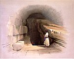
Gihon Spring (Hebrew: מעיין הגיחון) or Fountain of the Virgin, also known as Saint Mary's Pool, is a spring in the Kidron Valley. It was the main source of water for the Pool of Siloam in Jebus and the later City of David, the original site of Jerusalem. One of the world's major intermittent springs – and a reliable water source that made human settlement possible in ancient Jerusalem – the spring was not only used for drinking water, but also initially for irrigation of gardens in the adjacent Kidron Valley, which provided a food source for the ancient settlement. The spring rises in a cave 20 feet by 7, and is located 586 yards (535 m) northwards of the Pool of Siloam. Being intermittent, it required the excavation of the Pool of Siloam, which stored the large amount of water needed for the town when the spring was not flowing. Before the sinking of the water table due to overpumping in modern times, the spring used to flow three to five times daily in winter, twice daily in summer, and only once daily in autumn. This peculiarity is accounted for by the supposition that the outlet from the reservoir is by a passage in the form of a siphon. It has the largest output of water in the area - 600,000 cubic meters of water a year (compared to 125,000 cubic meters for the Lifta spring in West Jerusalem.The spring is under the control of the Israeli settler organization Ir David Foundation ("El'ad"); it is sometimes used by Jewish men as a sort of ritual bath (mikvah).

Siloam tunnel
Siloam tunnel

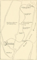
The newer Siloam Tunnel (Hebrew: נִקְבַּת הַשִּׁלֹחַ, Nikbat HaShiloaḥ), also known as Hezekiah's Tunnel (Hebrew: תעלת חזקיהו, Te'alát Ḥizkiyáhu), is a water tunnel that was carved within the City of David in ancient times, now located in the Arab neighborhood of Silwan in eastern Jerusalem. Its popular name is due to the most common hypothesis that it dates from the reign of Hezekiah of Judah (late 8th and early 7th century BC) and corresponds to the "conduit" mentioned in 2 Kings 20:20 in the Hebrew Bible. According to the Bible, King Hezekiah prepared Jerusalem for an impending siege by the Assyrians, by "blocking the source of the waters of the upper Gihon, and leading them straight down on the west to the City of David" (2 Chronicles 32:30). By diverting the waters of the Gihon, he prevented the enemy forces under Sennacherib from having access to water. Support for the dating to Hezekiah's period is derived from the Biblical text that describes construction of a tunnel and to radiocarbon dates of organic matter contained in the original plastering. However, the dates were challenged in 2011 by new excavations that suggested an earlier origin in the late 9th or early 8th century BC.The tunnel leads from the Gihon Spring to the Pool of Siloam. If indeed built under Hezekiah, it dates to a time when Jerusalem was preparing for an impending siege by the Assyrians, led by Sennacherib. Since the Gihon Spring was already protected by a massive tower and was included in the city's defensive wall system, Jerusalem seems to have been supplied with enough water in case of siege even without this tunnel. According to Aharon Horovitz, director of the Megalim Institute, the tunnel can be interpreted as an additional aqueduct designed for keeping the entire outflow of the spring inside the walled area, which included the downstream Pool of Siloam, with the specific purpose of withholding water from any besieging forces. Both the spring itself, and the pool at the end of the tunnel, would have been used by the inhabitants as water sources. Troops positioned outside the walls wouldn't have reached any of it, because even the overflow water released from the Pool of Siloam would have fully disappeared into a karstic system located right outside the southern tip of the city walls. In contrast to that, the previous water system did release all the water not used by the city population into the Kidron Valley to the east, where besieging troops could have taken advantage of it. The curving tunnel is 583 yards (533 m; about 1⁄3 mile) long and by using the 12 inch (30 cm) altitude difference between its two ends, which corresponds to a 0.06 percent gradient, the engineers managed to convey the water from the spring to the pool. According to the Siloam inscription, the tunnel was excavated by two teams, one starting at each end of the tunnel and then meeting in the middle. The inscription is partly unreadable at present, and may originally have conveyed more information than this. It is clear from the tunnel itself that several directional errors were made during its construction. Recent scholarship has discredited the idea that the tunnel may have been formed by substantially widening a pre-existing natural karst. How the Israelite engineers dealt with the difficult feat of making two teams digging from opposite ends meet far underground is still not fully understood, but some suggest that the two teams were directed from above by sound signals generated by hammering on the solid rock through which the tunnelers were digging.

Al-Aqsa Mosque
Al-Aqsa Mosque

Al-Aqsa Mosque, properly Jāmiʿ al-Aqṣā (Arabic: جامع الأقصى, lit. 'congregational mosque of Al-Aqsa [compound]'), also known as the Qibli Mosque or Qibli Chapel (Arabic: المصلى القبلي, romanized: al-muṣallā al-qiblī, lit. 'prayer hall of the qibla (south)'), is a congregational mosque or prayer hall in the Old City of Jerusalem. In some sources the building is also named al-Masjid al-Aqṣā, but this name and its English translation "Al Aqsa Mosque" itself, is disputed as it can instead apply to the whole compound in which the building sits. The wider compound is also known as the Haram al-Sharif, the Al-Aqsa Mosque compound (or simply Al-Aqsa), and the Temple Mount.During the rule of the Rashidun caliph Umar (r. 634–644) or the Umayyad caliph Mu'awiya I (r. 661–680), a small prayer house on the compound was erected near the mosque's site. The present-day mosque, located on the south wall of the compound, was originally built by the fifth Umayyad caliph Abd al-Malik (r. 685–705) or his successor al-Walid I (r. 705–715) (or both) as a congregational mosque on the same axis as the Dome of the Rock, a commemorative Islamic monument. After being destroyed in an earthquake in 746, the mosque was rebuilt in 758 by the Abbasid caliph al-Mansur. It was further expanded upon in 780 by the Abbasid caliph al-Mahdi, after which it consisted of fifteen aisles and a central dome. However, it was again destroyed during the 1033 Jordan Rift Valley earthquake. The mosque was rebuilt by the Fatimid caliph al-Zahir, who reduced it to seven aisles but adorned its interior with an elaborate central archway covered in vegetal mosaics; the current structure preserves the 11th-century outline. During the periodic renovations undertaken, the ruling Islamic dynasties constructed additions to the mosque and its precincts, such as its dome, façade, minarets, and minbar and interior structure. Upon its capture by the Crusaders in 1099, the mosque was used as a palace; it was also the headquarters of the religious order of the Knights Templar. After the area was conquered by Saladin in 1187, the structure's function as a mosque was restored. More renovations, repairs, and expansion projects were undertaken in later centuries by the Ayyubid Sultanate, the Mamluk Sultanate, the Ottoman Empire, the Supreme Muslim Council of British Palestine, and during the Jordanian occupation of the West Bank. Since the beginning of the ongoing Israeli occupation of the West Bank, the mosque has remained under the independent administration of the Jerusalem Islamic Waqf.Al-Aqsa Mosque is located in close proximity to various historical and holy sites in Judaism and Christianity, most notably that of the Temple in Jerusalem. The entire area has consequently held high geopolitical significance, and has been a primary flashpoint in the Israeli–Palestinian conflict.