place

Ophel

Ancient history of JerusalemArchitectural history
JPF Ophel City of David

Ophel (Hebrew: עֹ֫פֶל ‘ōp̄el), also Graecised to ophlas, is the biblical term given to a certain part of a settlement or city that is elevated from its surroundings, and probably means fortified hill or risen area. In the Hebrew Bible, the term is used in reference to two cities: Jerusalem, as in the Book of Chronicles (2 Chronicles 27:3; 33:14) and Book of Nehemiah (Nehemiah 3:26; 11:21), and Samaria, mentioned in the Books of Kings (2 Book of Kings 5:24). The Mesha Stele, written in Moabite, a Canaanite language closely related to Biblical Hebrew, is the only extra-biblical source using the word, also in connection to a fortified place.

Excerpt from the Wikipedia article Ophel (License: CC BY-SA 3.0, Authors, Images).

Ophel
ירידה לפיר וורן, Jerusalem Ras al-Amud

Geographical coordinates (GPS) Address Nearby Places
placeShow on map

Wikipedia: OphelContinue reading on Wikipedia

Geographical coordinates (GPS)

Latitude Longitude
N 31.774166666667 ° E 35.236111111111 °
placeShow on map

Address

תצפית בית הצופה

ירידה לפיר וורן
9114001 Jerusalem, Ras al-Amud
Jerusalem District, Israel
mapOpen on Google Maps

JPF Ophel City of David
Share experience

Nearby Places

City of David (archaeological site)

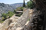
The City of David (Hebrew: עיר דוד, romanized: Īr Davīd), known locally mostly as Wadi Hilweh (Arabic: وادي حلوة), is the name given to an archaeological site considered by most scholars to be the original settlement core of Jerusalem during the Bronze and Iron Ages. It is situated on southern part of the eastern ridge of ancient Jerusalem, west of the Kidron Valley and east of the Tyropoeon valley, to the immediate south of the Temple Mount. The City of David is an important site of biblical archeology. Remains of a defensive network dating back to the Middle Bronze Age were found around the Gihon Spring; they continued to remain in use throughout subsequent periods. Two monumental Iron Age structures, known as the Large Stone Structure and the Stepped Stone Structure, were discovered at the site. Scholars debate if these may be identified with David or date to a later period. The site is also home to the Siloam Tunnel which according to a common hypothesis, was built by Hezekiah during the late 8th century BCE in preparation for an Assyrian siege. However, recent excavations at the site suggested an earlier origin in the late 9th or early 8th century BCE. Remains from the early Roman period include the Pool of Siloam and the Stepped Street, which stretched from the pool to the Temple Mount.The excavated parts of the archeological site are today part of the Jerusalem Walls National Park. The site is managed by the Israel Nature and Parks Authority and operated by the Ir David Foundation. It is located in Wadi Hilweh, an extension of the Palestinian neighborhood of Silwan, East Jerusalem, intertwined with an Israeli settlement.

Gihon Spring
Gihon Spring

Gihon Spring (Hebrew: מעיין הגיחון) or Fountain of the Virgin, also known as Saint Mary's Pool, is a spring in the Kidron Valley. It was the main source of water for the Pool of Siloam in Jebus and the later City of David, the original site of Jerusalem. One of the world's major intermittent springs – and a reliable water source that made human settlement possible in ancient Jerusalem – the spring was not only used for drinking water, but also initially for irrigation of gardens in the adjacent Kidron Valley, which provided a food source for the ancient settlement. The spring rises in a cave 20 feet by 7, and is located 586 yards (535 m) northwards of the Pool of Siloam. Being intermittent, it required the excavation of the Pool of Siloam, which stored the large amount of water needed for the town when the spring was not flowing. Before the sinking of the water table due to overpumping in modern times, the spring used to flow three to five times daily in winter, twice daily in summer, and only once daily in autumn. This peculiarity is accounted for by the supposition that the outlet from the reservoir is by a passage in the form of a siphon. It has the largest output of water in the area - 600,000 cubic meters of water a year (compared to 125,000 cubic meters for the Lifta spring in West Jerusalem.The spring is under the control of the Israeli settler organization Ir David Foundation ("El'ad"); it is sometimes used by Jewish men as a sort of ritual bath (mikvah).

Siloam tunnel
Siloam tunnel

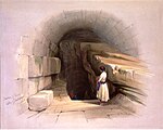
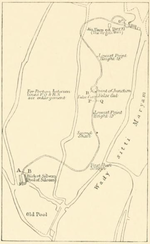
The newer Siloam Tunnel (Hebrew: נִקְבַּת הַשִּׁלֹחַ, Nikbat HaShiloaḥ), also known as Hezekiah's Tunnel (Hebrew: תעלת חזקיהו, Te'alát Ḥizkiyáhu), is a water tunnel that was carved within the City of David in ancient times, now located in the Arab neighborhood of Silwan in eastern Jerusalem. Its popular name is due to the most common hypothesis that it dates from the reign of Hezekiah of Judah (late 8th and early 7th century BC) and corresponds to the "conduit" mentioned in 2 Kings 20:20 in the Hebrew Bible. According to the Bible, King Hezekiah prepared Jerusalem for an impending siege by the Assyrians, by "blocking the source of the waters of the upper Gihon, and leading them straight down on the west to the City of David" (2 Chronicles 32:30). By diverting the waters of the Gihon, he prevented the enemy forces under Sennacherib from having access to water. Support for the dating to Hezekiah's period is derived from the Biblical text that describes construction of a tunnel and to radiocarbon dates of organic matter contained in the original plastering. However, the dates were challenged in 2011 by new excavations that suggested an earlier origin in the late 9th or early 8th century BC.The tunnel leads from the Gihon Spring to the Pool of Siloam. If indeed built under Hezekiah, it dates to a time when Jerusalem was preparing for an impending siege by the Assyrians, led by Sennacherib. Since the Gihon Spring was already protected by a massive tower and was included in the city's defensive wall system, Jerusalem seems to have been supplied with enough water in case of siege even without this tunnel. According to Aharon Horovitz, director of the Megalim Institute, the tunnel can be interpreted as an additional aqueduct designed for keeping the entire outflow of the spring inside the walled area, which included the downstream Pool of Siloam, with the specific purpose of withholding water from any besieging forces. Both the spring itself, and the pool at the end of the tunnel, would have been used by the inhabitants as water sources. Troops positioned outside the walls wouldn't have reached any of it, because even the overflow water released from the Pool of Siloam would have fully disappeared into a karstic system located right outside the southern tip of the city walls. In contrast to that, the previous water system did release all the water not used by the city population into the Kidron Valley to the east, where besieging troops could have taken advantage of it. The curving tunnel is 583 yards (533 m; about 1⁄3 mile) long and by using the 12 inch (30 cm) altitude difference between its two ends, which corresponds to a 0.06 percent gradient, the engineers managed to convey the water from the spring to the pool. According to the Siloam inscription, the tunnel was excavated by two teams, one starting at each end of the tunnel and then meeting in the middle. The inscription is partly unreadable at present, and may originally have conveyed more information than this. It is clear from the tunnel itself that several directional errors were made during its construction. Recent scholarship has discredited the idea that the tunnel may have been formed by substantially widening a pre-existing natural karst. How the Israelite engineers dealt with the difficult feat of making two teams digging from opposite ends meet far underground is still not fully understood, but some suggest that the two teams were directed from above by sound signals generated by hammering on the solid rock through which the tunnelers were digging.

Monolith of Silwan
Monolith of Silwan

The Monolith of Silwan, also known as the Tomb of Pharaoh's Daughter, is a cuboid rock-cut tomb located in Silwan, Jerusalem dating from the period of the Kingdom of Judah; the latter name refers to a 19th-century hypothesis that the tomb was built by Solomon for his wife, the Pharaoh's daughter. The structure, a typical Israelite rock-cut tomb, was previously capped by a pyramid structure like the Tomb of Zechariah. It is one of the more complete and distinctive First Temple-period structures. The pyramidal rock cap was cut into pieces and removed for quarry during the Roman era, leaving a flat roof. The tomb contains a single stone bench, indicating that it was designed for only one burial. Recent research indicates that the bench was the base of a sarcophagus hewn into the original building.The Pharaoh's daughter tradition was first suggested by Louis Félicien de Saulcy, who noted that the bible claims that Solomon built a temple for his Egyptian wife; de Saulcy, excavating the site in the 19th century, suggested that this might be the same building. However, subsequent archaeological investigation has dated the site to the 9th-7th century BC, making the connection to Solomon impossible. Two letters of a single-line Phoenician or Hebrew inscription survive on the building, the remainder of the inscription having been mutilated beyond recognition, by a hermit in the Byzantine era; Byzantine monks increased the height of the low entrance by removing rock which contained the inscription in order to ease access to the tomb, in which they resided. The tomb was cleaned following the 1967 Six-Day War. Neglected since Ussishkin's survey, trash disposal has resulted in an unkempt, unattractive appearance (as of 2013).