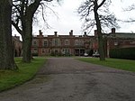
Crookham, Northumberland
Ford, NorthumberlandNorthumberland geography stubsUse British English from August 2019Villages in Northumberland

Crookham is a village on the River Till in Northumberland, in England. It is situated approximately 8 km (5.0 mi) to the east of Coldstream and 14 km (8.7 mi) northwest of Wooler. It has three farms, Crookham Sandyford, Crookham Eastfield, and Crookham Westfield. Recorded as "Crucum" in 1244, the village name derived from the Old English for "Settlement at the Bend" (of the River Till).
Excerpt from the Wikipedia article Crookham, Northumberland (License: CC BY-SA 3.0, Authors, Images).Crookham, Northumberland
B6353,
Geographical coordinates (GPS) Address Nearby Places Show on map
Geographical coordinates (GPS)
| Latitude | Longitude |
|---|---|
| N 55.637 ° | E -2.135 ° |
Address
B6353
TD12 4TA , Ford
England, United Kingdom
Open on Google Maps


