Thuringian-Franconian Highlands
Geography of BavariaGeography of ThuringiaGermany geography stubsHighlandsMountain ranges of Bavaria ... and 2 more
Mountain ranges of ThuringiaNatural regions of the Central Uplands
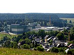
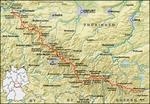
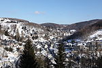
The Thuringian-Franconian Highlands (German: Thüringisch-Fränkische Mittelgebirge) are a natural region of Germany which is designated as D48 or 39 by the BfN. It consists mainly of a ridge of mountains up to just under 1,000 m high between the Central Upland areas of the Thuringian Forest, Thuringian Slate Mountains, Franconian Forest and Fichtel Mountains, and which runs from west and south Thuringia through Upper Franconia and southeast to just before the Czech border and the so-called Bohemian Massif.
Excerpt from the Wikipedia article Thuringian-Franconian Highlands (License: CC BY-SA 3.0, Authors).Thuringian-Franconian Highlands
Vorwerker Straße,
Geographical coordinates (GPS) Address Nearby Places Show on map
Geographical coordinates (GPS)
| Latitude | Longitude |
|---|---|
| N 50.4785 ° | E 11.2061 ° |
Address
Vorwerker Straße
96515
Thuringia, Germany
Open on Google Maps


