place

Little River (Damariscotta River tributary)

Maine river stubsRivers of Lincoln County, MaineRivers of Maine

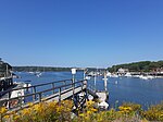
The Little River is a 2.1-mile-long (3.4 km) stream and tidal river on Linekin Neck in the town of Boothbay in the U.S. state of Maine. It is a small tidal river for its lower 1.4 miles (2.3 km), entering the Atlantic Ocean just west of the mouth of the Damariscotta River.

Excerpt from the Wikipedia article Little River (Damariscotta River tributary) (License: CC BY-SA 3.0, Authors).

Little River (Damariscotta River tributary)
River Bank Road,

Geographical coordinates (GPS) Address Nearby Places
placeShow on map

Wikipedia: Little River (Damariscotta River tributary)Continue reading on Wikipedia

Geographical coordinates (GPS)

Latitude Longitude
N 43.8288 ° E -69.5844 °
placeShow on map

Address

River Bank Road 60
04544
Maine, United States
mapOpen on Google Maps

Share experience

Nearby Places

Damariscotta River
Damariscotta River

The Damariscotta River is a 19.0-mile-long (30.6 km) tidal river in Lincoln County, Maine, that empties into the Atlantic Ocean. Damariscotta is an old Abenaki word for "river of many fishes". There are 2,500-year-old oyster shell middens (heaps) along the banks of the Damariscotta River, which occupies a drowned river valley leading to the Gulf of Maine, a large embayment of the Atlantic Ocean. The Damariscotta River begins at the outlet of Damariscotta Lake, at Damariscotta Mills, a village straddling the boundary between the towns of Newcastle and Nobleboro. Damariscotta Lake extends 12 miles (19 km) north into the town of Jefferson and is fed from tributaries originating as far north as Washington and Somerville, Maine. From the lake's outlet, the Damariscotta River drops 50 feet (15 m) over just 0.1 miles (0.16 km) through Damariscotta Mills before reaching tidewater, at an arm of the river known as Salt Bay. The tidal Damariscotta flows southward between Newcastle, Edgecomb and Boothbay on the west and Damariscotta, Bristol and South Bristol on the east, reaching the Atlantic Ocean between Linekin Neck on the west and Inner Heron Island on the east. It is a navigable river for nearly its entire 19-mile (31 km) length, to the bridge between Newcastle and Nobleboro (44°03′36″N 69°31′30″W). It is important in local commerce for tourism, Oyster and Mussel Farming as well as other forms of aquaculture, clamming, marine worming and fishing.