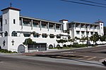
Azalea Park, San Diego
Neighborhoods in San DiegoVague or ambiguous time from July 2019

The Azalea Park neighborhood is a community within City Heights in the greater San Diego, California area. It is located on top of a plateau 3 miles east of San Diego Bay, with an elevation of around 300 feet. It is bordered to the north by Manzanita Canyon (Lexington Street, officially a paper street at the bottom of the canyon) Fairmount Avenue to the east, Interstate 805 to the west, and Hollywood Park to the south.
Excerpt from the Wikipedia article Azalea Park, San Diego (License: CC BY-SA 3.0, Authors, Images).Azalea Park, San Diego
Pepper Drive, San Diego
Geographical coordinates (GPS) Address Nearby Places Show on map
Geographical coordinates (GPS)
| Latitude | Longitude |
|---|---|
| N 32.733933333333 ° | E -117.10546111111 ° |
Address
Pepper Drive 4198
92105 San Diego
California, United States
Open on Google Maps


