Lower Rhine Plain
Regions of North Rhine-WestphaliaRhine

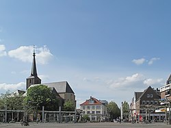
The Lower Rhine Plain (German: Niederrheinisches Tiefland) is one of the natural regions of Germany and lies on either side of the Rhine north of the city of Düsseldorf.
Excerpt from the Wikipedia article Lower Rhine Plain (License: CC BY-SA 3.0, Authors, Images).Lower Rhine Plain
Klüttenweg,
Geographical coordinates (GPS) Address Nearby Places Show on map
Geographical coordinates (GPS)
| Latitude | Longitude |
|---|---|
| N 51.536111111111 ° | E 6.3602777777778 ° |
Address
Klüttenweg
Klüttenweg
47608 (Kapellen)
North Rhine-Westphalia, Germany
Open on Google Maps


