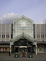
Stockport Air Raid Shelters

The Stockport Air Raid Shelters are a system of almost 1 mile (1.6 km) of underground air-raid shelters dug under Stockport, 6 miles (9.7 km) south of Manchester, during World War II to protect local inhabitants during air raids. Four sets of underground air raid shelter tunnels for civilian use were dug into the red sandstone rock below the town centre. Preparation started in September 1938 and the first set of shelters was opened on 28 October 1939; Stockport was not bombed until 11 October 1940. The smallest of the tunnel shelters could accommodate 2,000 people and the largest 3,850. It was subsequently expanded to take up to 6,500 people.In 1948, the shelters were sealed off from the public.The largest of the Stockport Air Raid Shelters have been open to the public since 1996 as part of the town's museum service.
Excerpt from the Wikipedia article Stockport Air Raid Shelters (License: CC BY-SA 3.0, Authors, Images).Stockport Air Raid Shelters
Chestergate,
Geographical coordinates (GPS) Address Nearby Places Show on map
Geographical coordinates (GPS)
| Latitude | Longitude |
|---|---|
| N 53.4098 ° | E -2.1608 ° |
Address
Upward Frog Yoga
Chestergate
SK1 1LZ , Shaw Heath
England, United Kingdom
Open on Google Maps


