place

Communications Security Establishment

1946 establishments in OntarioCanadian intelligence agenciesCommunications Security EstablishmentCryptography organizationsDepartment of National Defence (Canada)
Federal departments and agencies of CanadaGovernment agencies established in 1946Military intelligence agenciesSignals intelligence agencies
CSEC logo canada
CSEC logo canada

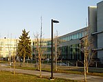
The Communications Security Establishment (CSE; French: Centre de la sécurité des télécommunications, CST), formerly (from 2008-2014) called the Communications Security Establishment Canada (CSEC), is the Government of Canada's national cryptologic agency. It is responsible for foreign signals intelligence (SIGINT) and communications security (COMSEC), protecting federal government electronic information and communication networks, and is the technical authority for cyber security and information assurance.Formally administered under the Department of National Defence (DND), the CSE is now a separate agency under the National Defence portfolio. The CSE is accountable to the Minister of National Defence through its deputy head, the Chief of CSE. The National Defence Minister is in turn accountable to the Cabinet and Parliament. The current Chief of the CSE is Caroline Xavier, who assumed the office on 31 August 2022.In 2015, the agency built a new headquarters and campus encompassing 340,000 m2 (84 acres). The facility totals a little over 110,000 m2 (1,200,000 sq ft) and is adjacent to CSIS.

Excerpt from the Wikipedia article Communications Security Establishment (License: CC BY-SA 3.0, Authors, Images).

Communications Security Establishment
Ogilvie Road, Ottawa Gloucester

Geographical coordinates (GPS) Address Nearby Places
placeShow on map

Wikipedia: Communications Security EstablishmentContinue reading on Wikipedia

Geographical coordinates (GPS)

Latitude Longitude
N 45.434 ° E -75.616 °
placeShow on map

Address

Edward Drake Building

Ogilvie Road 1929
K1J 0B9 Ottawa, Gloucester
Ontario, Canada
mapOpen on Google Maps

CSEC logo canada
CSEC logo canada
Share experience

Nearby Places

Carson Meadows
Carson Meadows

Carson Meadows is a neighbourhood in Rideau-Rockcliffe Ward in the east end of Ottawa, Ontario, Canada. It is roughly located south of Montreal Road and north of Collège La Cité, west of the National Research Council National Science Library site, and generally east of Carsons Road. This area has an approximate population of 3300 (2016 Census). The neighbourhood has a plurality Francophone population. The five dissemination areas that cover most of the area together are 40% Francophone and 39% Anglophone. Creole languages are the third largest linguistic group at 6%.The area was once known as Rockville, with a post office opening up in 1871. The area went through a number of names such as Robillard and Rock Village, with the post office being renamed to Quarries in 1903, and closing in 1961. The area was home to a number of quarries which provided stones for Parliament Buildings among other places in the Ottawa area. The quarries would later be renamed. The "Quarries" name still appears on some maps of the area, as it is recorded under that name by the Geographical Names Data Base.A subdivision was built in the area in the early 1960s by Mastercraft Homes, and sold by Guaranty Trust Company of Canada. This subdivision was originally called Carson's Meadows. As of 1965, the neighbourhood consisted of a few houses on Hochelaga Street, the Carson Hill Apartments on Carsons Road, and a subdivision between Bermuda Avenue and Charleswood Avenue. Over the next decade, the Summerhill subdivision was built on Bathgate Dr, as well as the Hochelaga Rental Homes, the CrossWinds apartments, Las Brisas apartments and the Carson's Community Ottawa Housing project. By 1991, the Bathgate Court Ottawa Housing project and the Concorde Apartments were built. Over the next decade, the Desloges Cooperative Housing was built.