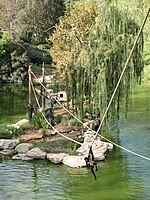
Al-Walaja

Al-Walaja (Arabic: الولجة) is a Palestinian village in the West Bank, four kilometers northwest of Bethlehem. It is an enclave in the Seam Zone, near the Green Line. Al-Walaja is partly under the jurisdiction of the Bethlehem Governorate and partly of the Jerusalem Municipality. According to the Palestinian Central Bureau of Statistics, the village had a population of 2,671 in 2017. It has been called 'the most beautiful village in Palestine'.Al-Walaja was depopulated during the 1948 Arab-Israeli War, in October 1948. It lost about 70% of its land, west of the Green Line. After the war, the displaced inhabitants resettled on the remaining land in the West Bank. After its occupation by Israel during the Six-Day War, Israel annexed about half of al-Walaja's remaining land, including the neighborhood Ain Jawaizeh, to the Jerusalem Municipality. Large parts of the land were confiscated for the construction of the Israeli West Bank barrier and the Israeli settlements of Har Gilo and Gilo, one of the Ring Neighborhoods of Jerusalem.
Excerpt from the Wikipedia article Al-Walaja (License: CC BY-SA 3.0, Authors, Images).Al-Walaja
Jerusalem Givat Massuah
Geographical coordinates (GPS) Address Nearby Places Show on map
Geographical coordinates (GPS)
| Latitude | Longitude |
|---|---|
| N 31.735555555556 ° | E 35.160833333333 ° |
Address
9674625 Jerusalem, Givat Massuah
Jerusalem District, Israel
Open on Google Maps


