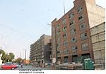
Southside Park, Sacramento, California
Neighborhoods in Sacramento, California
Southside Park is a neighborhood in Sacramento, California, located immediately south of Downtown Sacramento. Its official borders are R Street to the north, W-X Freeway to the south, I-5 to the west, and 12th Street to the east. Southside Park is part of the City of Sacramento's South Side Historic District. A large park with a natural pond sits at the center of the community. The park hosts several annual celebrations and the popular Sunday Farmers Market is held all year south of the park under the overpass at W-X Streets.
Excerpt from the Wikipedia article Southside Park, Sacramento, California (License: CC BY-SA 3.0, Authors).Southside Park, Sacramento, California
Tomato Alley, Sacramento
Geographical coordinates (GPS) Address Nearby Places Show on map
Geographical coordinates (GPS)
| Latitude | Longitude |
|---|---|
| N 38.5695 ° | E -121.5006 ° |
Address
Tomato Alley 930
95818 Sacramento
California, United States
Open on Google Maps


