place

Nashville, California

Cosumnes RiverEl Dorado County, California geography stubsMining communities of the California Gold RushUnincorporated communities in CaliforniaUnincorporated communities in El Dorado County, California
Use mdy dates from July 2023

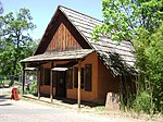
Nashville (formerly, Nashville Bar, Quartzville, and Quartzburg) is an unincorporated community in El Dorado County, California. It is located on the North Fork of the Cosumnes River 10.5 miles (17 km) south of Placerville, at an elevation of 863 feet (263 m).The place was first called Nashville Bar, then Quartzville and Quartzburg, before being named for Nashville, Tennessee.Described as "quite a busy town" in 1852, Nashville had a store and boarding house in support of the nearby mines. The nearby Montezuma mine operated into the 1930s, at which time Nashville still had hundreds of residents, a school, and post office; by 1977 all but one business were gone and only thirteen residents remained.A post office operated in Nashville from 1852 to 1854 and from 1870 to 1907.

Excerpt from the Wikipedia article Nashville, California (License: CC BY-SA 3.0, Authors).

Nashville, California
CA 49,

Geographical coordinates (GPS) Address Nearby Places
placeShow on map

Wikipedia: Nashville, CaliforniaContinue reading on Wikipedia

Geographical coordinates (GPS)

Latitude Longitude
N 38.578888888889 ° E -120.84527777778 °
placeShow on map

Address

CA 49 7898
95623
California, United States
mapOpen on Google Maps

Share experience

Nearby Places

Plymouth Trading Post

The Plymouth Trading Post is a brick building in Plymouth, California in Amador County, United States. The brick building was built in 1857 by hand by Joe Williams in 1857, to be his Trading Post. The Trading Post closed and the building became the headquarters of Plymouth Consolidated Mine in 1873. Plymouth Consolidated Mine was formed when a number of small mines combined. The building was the Plymouth Consolidated Mine main office and its commissary. Plymouth Trading Post is registered as California Historical Landmark #41, starting August 30, 1950. The Trading Post served the town and nearby Plymouth Mine. The building survived the 1877 that burned down much of the town. The brick walls foundations are 30 inches thick. The floor support beams are 12x12 inches of wood. Joe Williams "dug" the basement with dynamite to remove the shale rock below the building. There were hitching posts ring on the side of the building. Plymouth Consolidated Mine's Pacific shaft, was the deepest hard rock shaft at 4,450 feet by 1925 working the Plymouth gold vain. The main haul of gold was between 1883 and 1889, when it operated 160 stamps that crushed 400 tons of quartz ore a day. The Plymouth Consolidated Mine mined over $13,500,000 dollars of gold and closed in 1947. Some of the mines that Consolidated in 1883 were: Plymouth, Empire, and Amador Pacific mining companies. The mines were all located in the northern part of Mother Lode Gold Belt of the Sierra Nevada foothills at an elevation of 332 feet. After consolidation, the company had 126.3 acres of land that included: the Plymouth, Southerland, Oaks, Pacific, Simpson, Aden, Reese, Phoenix East claims, the Phoenix mill site, and interests in the Reese and Woolford, Indiana, Rising Star, Conville, and Beta claims. The first gold in the area was found in 1852. The Plymouth Consolidated Mine was idle from 1892 to 1911.