Carrington Moss

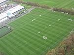
Carrington Moss is a large area of peat bog near Carrington, Greater Manchester, England, south of the River Mersey, 10 miles (16 km) south-west of Manchester. It occupies an area of about 1,100 acres (450 ha). The depth of peat varies between 17 and 20 feet (5.2 and 6.1 m). Originally an unused area of grouse moorland, the moss was reclaimed in the latter half of the 19th century for farming and the disposal of Manchester's waste. A system of tramways was built to connect it with the Manchester Ship Canal and a nearby railway line. In the Second World War, the land was used as a Starfish site and in the latter half of the 20th century a large industrial complex was built along its northern edge. More recently, several sporting facilities have been built on Carrington Moss. The land is still used for farming and several nature reserves have been established within its bounds. Parts of Carrington Moss are accessible to the public over several rights of way.
Excerpt from the Wikipedia article Carrington Moss (License: CC BY-SA 3.0, Authors, Images).Carrington Moss
Brookhays Road, Trafford Carrington
Geographical coordinates (GPS) Address Nearby Places Show on map
Geographical coordinates (GPS)
| Latitude | Longitude |
|---|---|
| N 53.4205 ° | E -2.3877 ° |
Address
Brookhays Road
Brookhays Road
WA14 5SY Trafford, Carrington
England, United Kingdom
Open on Google Maps


