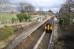
Flixton, Greater Manchester

Flixton is a suburb and electoral ward in the Metropolitan Borough of Trafford, Greater Manchester, England. The population of the ward at the 2011 census was 10,786. It lies six miles (9.7 km) southwest of Manchester city centre, in the historic county of Lancashire. Neolithic and Bronze Age artefacts have been found locally and the area may have been inhabited then. Medieval Flixton was a parish within the Hundred of Salford and manor of Flixton, first mentioned in the 12th century. The parish comprised isolated farmsteads and a manor house. Toward the end of the 17th century its population began to rise, continuing through the 19th century, although at a much slower pace than its neighbours. Flixton was a remote rural area with few transport links and did not witness the level of industrialisation other parts of Manchester saw, but its connection to the railway network in 1873 helped transform the area into a middle-class suburb. Flixton is represented in Parliament by Labour MP Andrew Western.
Excerpt from the Wikipedia article Flixton, Greater Manchester (License: CC BY-SA 3.0, Authors, Images).Flixton, Greater Manchester
Woodsend Road South, Trafford Woodsend
Geographical coordinates (GPS) Address Nearby Places Show on map
Geographical coordinates (GPS)
| Latitude | Longitude |
|---|---|
| N 53.447 ° | E -2.391 ° |
Address
Woodsend Road South
Woodsend Road South
M41 6PA Trafford, Woodsend
England, United Kingdom
Open on Google Maps


