Lower Huron Metropark
Huron River (Michigan)Huron–Clinton MetroparksProtected areas of Wayne County, MichiganSoutheast Michigan geography stubs

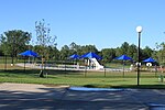
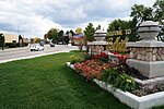
Lower Huron Metropark is a park in the Huron-Clinton system of metro parks in Metro Detroit. The park covers 1,258 acres (5.09 km2) along the Huron River and has hike-bike trails and two self-guided nature trails. In the winter, the park has cross-country skiing. The park also has a water slide amusement facility, the Turtle Cove Family Aquatic Center. There is a 27-site campground, a group campground and canoe camping in the park.Situated in the flood plain of the Huron River, some parts of the park may flood, especially when Belleville Dam releases excess water.
Excerpt from the Wikipedia article Lower Huron Metropark (License: CC BY-SA 3.0, Authors, Images).Lower Huron Metropark
South Metro Parkway,
Geographical coordinates (GPS) Address Nearby Places Show on map
Geographical coordinates (GPS)
| Latitude | Longitude |
|---|---|
| N 42.175036111111 ° | E -83.427647222222 ° |
Address
South Metro Parkway
South Metro Parkway
Michigan, United States
Open on Google Maps


