Upper and Lower Table Rock

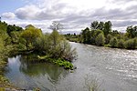
Upper Table Rock and Lower Table Rock are two prominent volcanic plateaus located just north of the Rogue River in Jackson County, Oregon, U.S. Created by an andesitic lava flow approximately seven million years ago and shaped by erosion, they now stand about 800 feet (240 m) above the surrounding Rogue Valley. The Table Rocks are jointly owned; The Nature Conservancy is responsible for 3,591 acres (1,453 ha), while the Bureau of Land Management is responsible for 1,280 acres (520 ha). Native Americans have inhabited the Table Rocks area for at least 15,000 years before European-American settlement. Starting in the mid-19th century during a gold rush, the settlers forced the Takelma tribe away from the Table Rocks and into reservations. The surrounding area was quickly developed. The Table Rock post office was established in 1872, an airstrip was built atop Lower Table Rock in 1948, and a very high frequency omni-directional range (VOR) aviation tower was constructed on Upper Table Rock in the 1960s. The Table Rocks were not protected until the 1970s. The rocks are home to over 70 species of animals and 340 species of plants, which includes over 200 species of wildflowers. Vernal pools atop the plateaus fill during the rainy season in winter and spring because the andesite is impermeable. The dwarf woolly meadowfoam, a species of wildflower, grows around these pools, and is endemic to the rocks. The pools are also one of only a few places where the federally threatened species of fairy shrimp, Branchinecta lynchi, can be found. To protect these and other threatened species, the Bureau of Land Management has listed the rocks as an Area of Critical Environmental Concern since 1984. The Table Rocks are one of the most popular hiking locations in the Rogue Valley, with over 45,000 visitors annually. Two trails, Lower Table Rock Trail and Upper Table Rock Trail, were cut across the plateaus' slopes in the early 1980s by the Youth Conservation Corps, Boy Scouts, and the Oregon Department of Forestry. This effort was coordinated by John Ifft, a forester for the Medford Office of the BLM. The plateaus are named for their relatively flat tops. Upper and Lower refer to their location along the Rogue River, not their height. Upper Table Rock, 2,091 feet (637 m) above sea level at its highest point, is located upstream, while Lower Table Rock is farther downstream, with an elevation of 2,049 feet (625 m).
Excerpt from the Wikipedia article Upper and Lower Table Rock (License: CC BY-SA 3.0, Authors, Images).Upper and Lower Table Rock
Table Rock Road,
Geographical coordinates (GPS) Address Nearby Places Show on map
 Continue reading on Wikipedia
 Geographical coordinates (GPS)
| Latitude | Longitude |
|---|---|
| N 42.465 ° | E -122.935 ° |
Address
Table Rock Road 12233
97502
Oregon, United States
Open on Google Maps