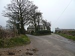
Ashover

Ashover is a village and civil parish in the English county of Derbyshire. It is in the North East Derbyshire district of the county. The population of the civil parish taken at the 2011 Census was 1,905. It sits in a valley, not far from the town of Matlock and the Peak District national park. The centre of the village is a conservation area. The River Amber flows through the village. Although Ashover is a small settlement, the actual ward boundaries of the village extend for many miles, including the nearby settlements of Alicehead, Alton, Ashover Hay, Farhill, Kelstedge, Littlemoor, Milltown, Spitewinter, Stone Edge and Uppertown. The two major roads, running through the parish, are the A632 from Matlock to Chesterfield, and the A615 from Matlock to Alfreton. The area along that part of the A615 is named Doehole. Slack is a small hamlet, within the parish, which is south west of Kelstedge on the A632; nearby to there, on Robridding Road (off Wirestone Lane), is the Eddlestow Lot Picnic Site, which has been developed in the former Wirestone Quarry: it is surrounded by heathland vegetation. The picnic site provides a good base to explore the local Public Rights of Way. Circular walks are waymarked from the car park, a leaflet is available by contacting the County Council. There is public access into many of the adjacent Forestry Commission owned woodlands. The site has plants including heather and bilberry. The other numbered roads in the parish are the B5057 from near North Brittain to Stone Edge, the B6036 between Kelstedge and Dalebank running past Ashover itself, and the B6014 from near Butterley to just past Ashover Hay. Fallgate is a hamlet beside the River Amber, in the south-east corner of the parish, off the B6036 to Woolley Moor and Handley.
Excerpt from the Wikipedia article Ashover (License: CC BY-SA 3.0, Authors, Images).Ashover
Milken Lane, North East Derbyshire
Geographical coordinates (GPS) Address Website Nearby Places Show on map
Geographical coordinates (GPS)
| Latitude | Longitude |
|---|---|
| N 53.163 ° | E -1.477 ° |
Address
Ashover Parish Hall
Milken Lane
S45 0AD North East Derbyshire
England, United Kingdom
Open on Google Maps


