Woolley Moor
Derbyshire geography stubsHamlets in DerbyshireNorth East Derbyshire DistrictTowns and villages of the Peak District

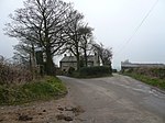
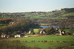
Woolley Moor is a small village in the North East Derbyshire district of Derbyshire, England. Its amenities include a school, a church and a public house called the White Horse. Almost all of the villagers work outside the village although there are two family run dairy farms creating employment for a handful of people.
Excerpt from the Wikipedia article Woolley Moor (License: CC BY-SA 3.0, Authors, Images).Woolley Moor
Beresford Lane, North East Derbyshire
Geographical coordinates (GPS) Address Nearby Places Show on map
Geographical coordinates (GPS)
| Latitude | Longitude |
|---|---|
| N 53.149 ° | E -1.451 ° |
Address
Beresford Lane
DE55 6FG North East Derbyshire
England, United Kingdom
Open on Google Maps


